
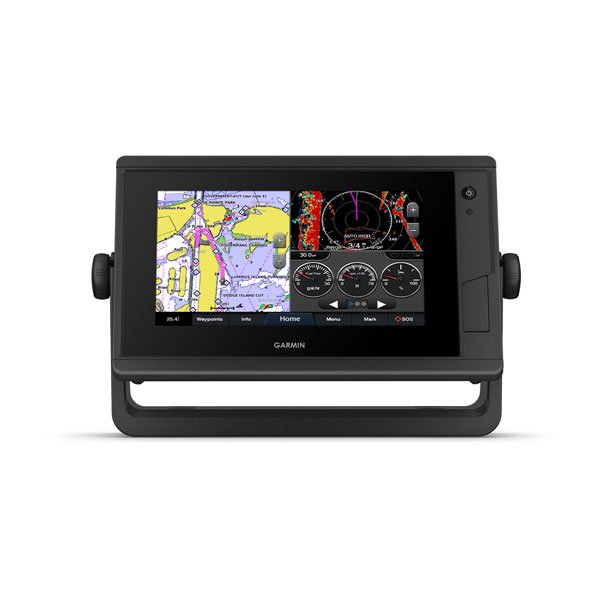
Garmin GPSMAP 742 Plus
The GPSMAP 742 Plus is a 7-inch touchscreen chartplotter that comes with BlueChart g3 coastal charts and LakeVü g3 inland maps already loaded. You get detailed coverage of US coastal waters and inland lakes right out of the box, with Auto Guidance technology to help you plot a course around hazards. The display is bright and sunlight-readable, and the touchscreen is responsive enough to use with wet hands on the water.
What It Does on the Water
The GPSMAP 742 Plus connects to your Garmin Marine Network to share maps, radar, sonar, and IP camera feeds across multiple units on the same boat. It supports NMEA 2000 and NMEA 0183 for autopilots, VHF, AIS, digital switching, and other sensors. Built-in Wi-Fi connects to the ActiveCaptain app for software updates, chart purchases, and access to the Garmin Quickdraw Contours community.
It pairs with Panoptix and LiveScope sonar via a compatible black box sonar module, sold separately. For sailors, it includes laylines, race start line guidance, wind rose, true wind data, and set and drift on screen. Engine connectivity supports Yamaha and other compatible engines, showing RPMs, fuel flow, and temperature at a glance.
Professional Installation at Ben's Marine
Our technicians can mount your GPSMAP 742 Plus, wire it into your Garmin Marine Network, connect your sonar module, and get everything calibrated before you leave the dock.
Ben's Marine can handle:
- GPSMAP 742 Plus installation and mounting
- Garmin Marine Network setup
- Sonar module and transducer wiring
- Autopilot and engine sensor connections
- Software updates and on-screen calibration
Ready to order or have questions about your setup? Call or text us at (218) 820-9781. We're located in the Brainerd Lakes area and ship nationwide.
Features
Specs
What's Included
Best For
Important Notes